Please patronize our sponsors. Ads with links are clickable.

bar_eleg.gif (11170 bytes)

[Riser Ditch Index]

Riser Ditch
Berry's Creek to Teterboro Airport


2.jpg (148516 bytes)

Riser Ditch Photographic Tour
Photo tour views are from north to south

East Riser Ditch
[East Riser Ditch] From Route 46, between Riser Road and   Fred Wehran Drive

West Riser Ditch
[Behind Hilton] Between Route 80, 47, 17 & Polifly Road & railroad tracks
[Between Route 80 & Route 46] North of Teterboro Train Station
From Train Station along railroad tracks/Route 17 [a][b][c] to Franklin Avenue Bridge
From Train Station along tracks/Industrial Ave. [a][b][c] to Franklin Ave. Bridge
[@ Franklin Ave. Bridge]
Airport along perimeter [@ Bend on Industrial Ave.] [@ Bridge on Industrial Ave.]
From Franklin Avenue Bridge [Along Railroad Tracks] to Wood Ridge


Illustrations
[Overall view] [Berry's Creek to Teterboro Airport]
[East & West Riser Ditch at Teterboro Airport]
[The Hackensack River Watershed] [Meadowlands refuge area]


###


####


Please patronize our sponsors. Ads with links are clickable.

bar_eleg.gif (11170 bytes)


·  Photo Features  ·
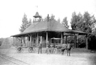
George Washington Bridge
[Index]
Paterson Great Falls [General Photos][Background info][Hydroelectric plant]
Secaucus Junction
Grand Opening  [Index]
Mail Factory Migrates To Teterboro [ Sneak preview][Ribbon cutting]
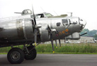
"The Wright Stuff"100 Years of Aviation [Index]


Please patronize our sponsors. Ads with links are clickable.

bar_eleg.gif (11170 bytes)

regional news, information and features
  LOGO.GIF (7473 bytes)
[Advertising Information]  [Policy Statement]      MAIL.GIF (4196 bytes)   [E-mail: Webmaster]      
   Please report broken links.  Submissions welcome.  Site established 1998.  © 1998-2018.  All Rights Reserved
Permission required for any commercial reproduction of photographs used herein.
Site developed and maintained by [The Iron Horse Advertising & Marketing Co. Inc.]
####